Auburn is a small town with a population just under 14,000 people, located 15 minutes east of Sierra College off I-80. Historically the town developed as a gold mining settlement, eventually
evolving into a river town that attracts many Californians.
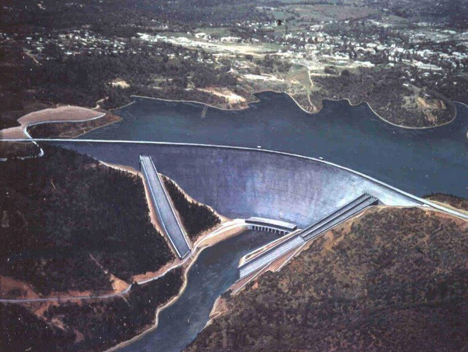
What most don’t know is that Auburn was supposed to be a lake town, with one of the largest dams in America holding back an enormous amount of water.
The trails of Auburn should have been underwater, and the infamous Foresthill Bridge should have sat near water level, rather than becoming the tallest bridge in California. The project, despite approval from Congress and construction, came to a halt due to several factors.
Why was one of the largest public works projects in American history forgotten? This article explains why the dam is unfinished, how water irrigation systems were affected, and what
Auburn has to offer in replacement of a massive lake.
Water, Power, and Floods
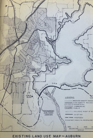
California is known for its dry climate; however, that doesn’t change the fact that the Central Valley of California remains extremely vulnerable to floods, including the State Capital, Sacramento.
The capital has experienced devastating floods throughout the years shown on Sacramento Flood Control Agency’s website. Floods have taken the city since the beginning of California history.
Efforts to maintain and protect California’s farmlands such as the Central Valley Plan, originally proposed by the State of California, later taken over by the Bureau of Reclamation would shape water irrigation throughout the State.
One of the projects proposed is not far from Sierra: a known swimming spot, Folsom Reservoir.
Folsom’s Dam and Auburn’s Plan
Folsom dam began storing water in 1955. The gravity dam produces hydroelectric energy, provides protection for Sacramento, and creates 75 miles of shoreline according to the Water Education Foundation.
Despite this massive project, floods plagued the area in the years following its completion and doubts surrounding Folsom’s original design called for action.
As a result, the Auburn Dam Project finally got its sign of approval in 1965 and was announced to the public in 1967.
The bulk of the project was organized and managed by The Bureau of Reclamation and backed by those who anticipated rough flood seasons and a possible new lake with recreational use. Auburn dam would have served many of the same functions as Folsom but on a larger scale.
Rerouting a River
Auburn’s dam would have held almost double the water of Folsom and would have an arch design. This allowed for a thin concrete structure, while still reaching 800 feet making it the tallest dam in California, according to Geo Engineer.
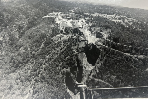
The Auburn Dam Watch has tracked construction of the dam for decades, showing that construction started in the 1970’s with things moving quickly. Foresthill Bridge was opened in 1973, along with strategic excavation of the site.
Coffer Dam was built just upstream to provide a buffer for construction, along with a full rerouting of the river; all to prepare for full-scale construction.
Earthquake Shakeup
Originally, surveys of the grounds confirmed this site was ideal for a dam. In 1975, that belief was shattered by the Oroville earthquake stemming from a fault previously believed to be inactive that connects directly to the site of the Auburn Dam.
The 5.7 magnitude earthquake made locals and architects reconsider the projects as a whole. As the budgets went up, administration changes, and skepticism involving the project arose, the Bureau of Reclamation’s dam construction came to a halt.
Tony Firenzi, Director of Strategic Affairs at the Placer County Water Agency was asked what the main reasons were for the dam’s suspension in an interview. He said:
“Having that earthquake triggered the cost overload. It set the project back about five years at a very inconvenient time where there was a political shift on how much water we needed.”
Many still advocated for approval. However, by the end, a dam of that scale would never be built in the US again.
Moving to Spillways
Sacramento’s protection now rests on smaller scale renovations to the Folsom Dam and levees scattered throughout the Foothills. Gary Bardini, director of planning at the Sacramento Flood Control Agency said in an interview:
“Between those improvements, we feel we’ve kind of gotten the equivalent of what the Auburn Dam would have provided.”
He continued, “We’re continuing to look beyond just Folsom. We’re now looking at modifications to spillways to get additional storage and we’re going with more cost-efficient projects today.”
While Sacramento remains flood-prone, the need for a second large dam on the American River has been squashed. In place of the Dam, the small town of Auburn has flourished without the expected lake; with only monuments of construction left behind.
Between the North & Middle Forks
In 2026, Auburn is known for the Auburn State Recreation Area that covers 40-miles of the North and Middle Forks of the American River. It attracts on average 900,000 visitors a year. Not to mention the infamous Western States 100-mile Race that ends in Auburn and goes through the Park, making the town the endurance capital of the world.
Access to the nearby rivers, trails, and outdoor experiences feed Auburn’s culture with positive attributes. Auburn State Recreation Area employee Joseph Shannahan points out in an interview:
“The canyons make Auburn what it is… In an alternate universe, we would have been a muddy pit.”
Within the 40-miles, people can hike, kayak, boat, hunt, fish, rock climb, raft, and use off-roading vehicles. According to Shannahan, this makes it, “…one the most diverse recreation areas within the state.”
Auburn Dam may never be built but this isn’t because the project was a disaster. Instead, groups of Californians have improved previous plans to sustain the valley and will continue to do so. And locals and travelers alike will continue to explore and appreciate the terrain.
*Featured photo shared by Sacramento Flood Control Agency’s Director of Strategic Affairs Tony Firenzi.
Reported and Written by Charlotte White